农业大数据学报 ›› 2025, Vol. 7 ›› Issue (1): 43-50.doi: 10.19788/j.issn.2096-6369.100034
• “一带一路”沿线农业资源环境监测与分析专栏 • 上一篇 下一篇
李淑华1( ), 李晓岚1, 刘玉1,*(), 高秉博2, SUKHBAATAR Chinzorig3, 冯爱萍4, 李存军1, 任艳敏1
LI ShuHua1(), LI XiaoLan1, LIU Yu1,*(), GAO BingBo2, Sukhbaatar Chinzorig3, FENG AiPing4, LI CunJun1, REN YanMin1
摘要:
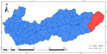
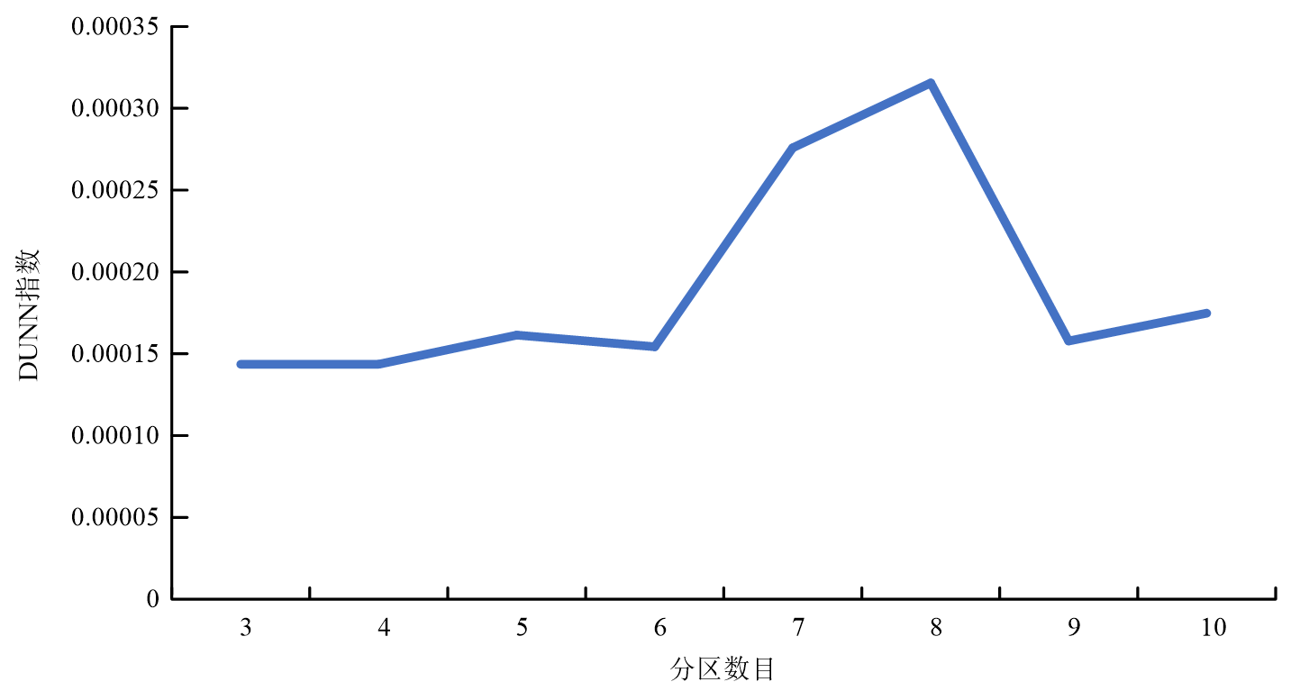
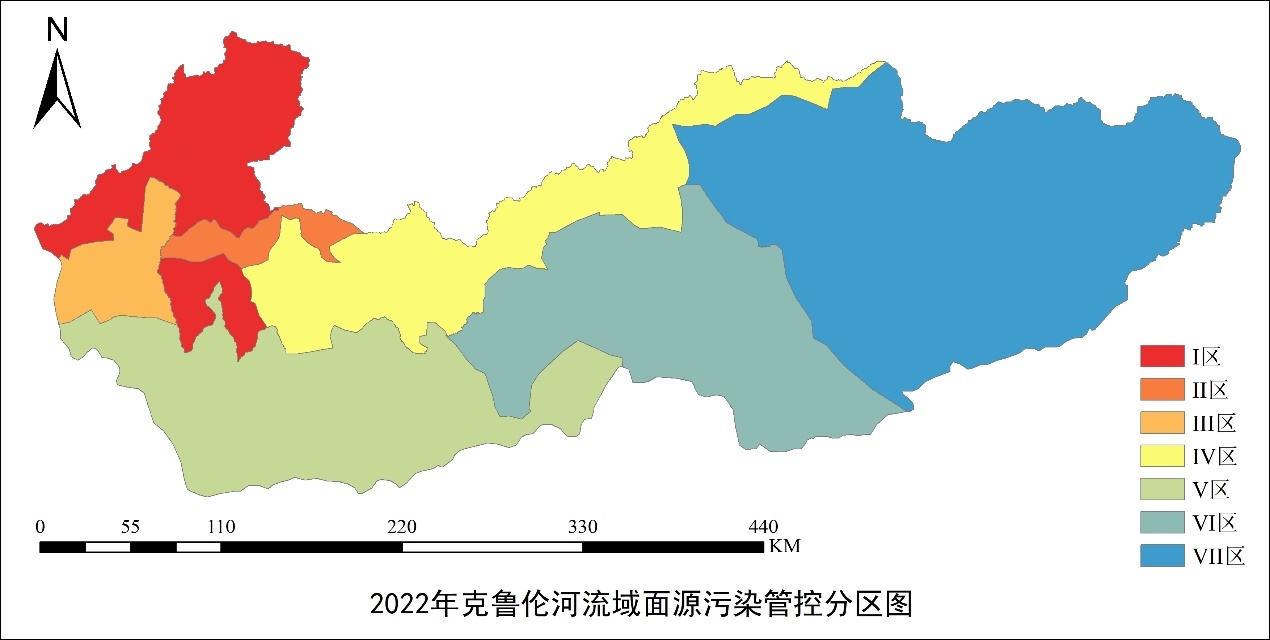
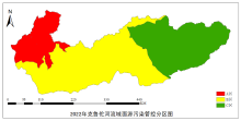
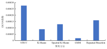
克鲁伦河流域生态环境安全直接关乎中蒙两国流域可持续发展水平,科学划分面源污染管控单元对于该流域实现水环境精准施策和高效管理具有重要意义。然而,当前该区域在污染管控方面缺乏有效的分区数据来指导具体施策。传统的污染管控单元划分方法,难以精确反映草原面源污染的差异性,从而在一定程度上影响了管理效果。草原面源污染受多重因素影响,其地理属性在属性上呈现出重复性,同时在空间分布上又表现出连续性。为了更准确地捕捉这些特征,需要一种能够平衡处理属性重复与空间连续的聚类方法。本研究针对克鲁伦河流域,面向草原面源污染影响因素,综合考虑了年平均降水、气温、数字高程、草地载畜强度以及土壤全氮磷含量等关键连续数据,利用能有效处理属性依赖关系和空间一致性策略的空间Toeplitz逆协方差聚类(STICC)方法进行聚类分析,构建了2022年克鲁伦河流域面源污染管控分区数据集。为了验证该数据集的精确性,采用DUNN聚类精度评价指标对该分区效果与其他传统分区结果进行了对比,结果显示:STICC方法在聚类精度上优于K-Means、Spectral K-Means、GMM及Repeated Bisection等方法,能够更有效地识别污染的异质性区域,进而显著提升管理的精细度。此外,本研究还保留了数据的原始连续性,使得对污染特征的刻画更为准确。相较于传统方法,本研究提供的分区数据在细节展现上提升了50%以上。该数据集不仅为深入研究克鲁伦河流域的面源污染特征提供了有力支持,还为相关管控决策提供了坚实的数据基础。
数据摘要:
| 项目 | 描述 |
|---|---|
| 数据库(集)名称 | 2022年克鲁伦河流域草原面源污染管控分区数据集 |
| 所属学科 | 土地资源与信息技术 |
| 研究主题 | 面源污染管控分区 |
| 数据时间范围 | 2022年 |
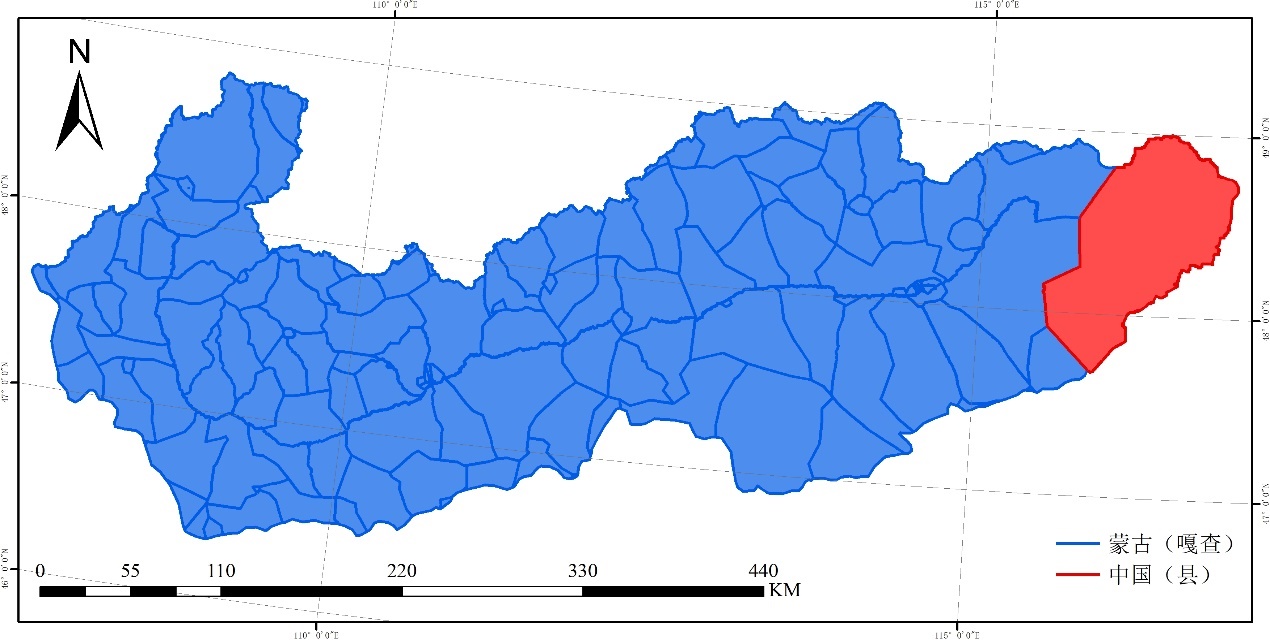
| 数据地理空间覆盖 | 克鲁伦河流域 |
| 空间分辨率 | 1 km |
| 数据类型与技术格式 | 矢量数据 |
| 数据库(集)组成 | 数据集包括2022年克鲁伦河流域面源污染管控分区专题地图和基础数据集,专题地图由一级管控分区和二级管控分区2幅图组成,基础数据集由6个分区关键指标数据文件构成 |
| 数据量 | 163.8 MB |
| 主要数据指标 | 面源污染一级管控分区、面源污染二级管控分区 |
| 数据可用性 | https://doi.org/10.57760/sciencedb.08471; |
| 经费支持 | 国家重点研发计划项目克鲁伦河流域面源污染遥感监测与评估技术研发(2021YFE0102300) |